Ha Giang loop: 5 days of epic motorbike rides
The Ha Giang Loop is one of Vietnam's seven most beautiful routes, as chosen by Lonely Planet. This road is still wild and keeps its original beauty. However, it is also very challenging, with dangerous mountain passes, deep valleys, and sharp karst peaks that test even the best riders.
On many travel forums and groups, the "Ha Giang Loop" is a popular topic. If you search for the hashtag "#Hagiangloop" on Instagram, you will find nearly 62,000 posts about it.
This guide will walk you through why the Ha Giang Loop is a must-do, and a detailed 5 days itinerary with all need-to-know tips for your trip. Scroll down to know more!
Why the Ha Giang Loop, Vietnam is a Top Choice for Adventure Travelers?
The Ha Giang Loop is one of the most amazing road trips in Southeast Asia. It's a journey recommended for those who love adventure travel.
The Ha Giang Loop route starts from Quản Bạ, passes through Yên Minh, up to Đồng Văn, goes through Mèo Vạc, and then returns to Quản Bạ.
The Ha Giang Loop is 350 km long, winding through mountains, high passes, deep valleys, geological faults, and gorges.
The route includes Mã Pì Lèng, one of Vietnam's four great passes. It also crosses areas where 22 ethnic groups live, offering rich local cuisine and fascinating culture.
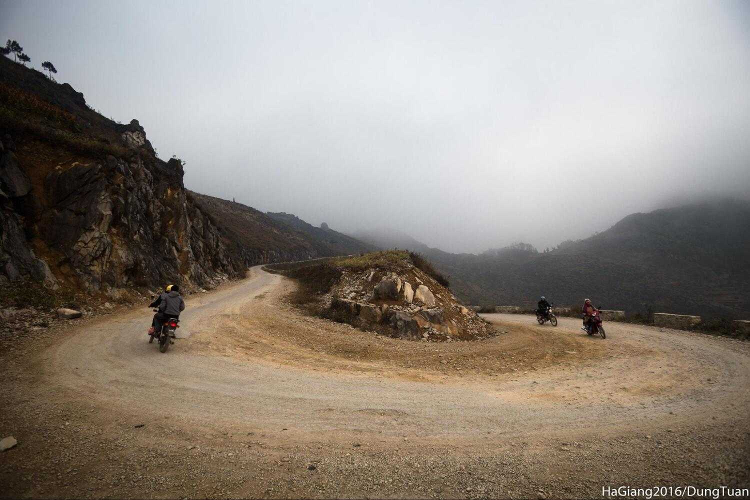
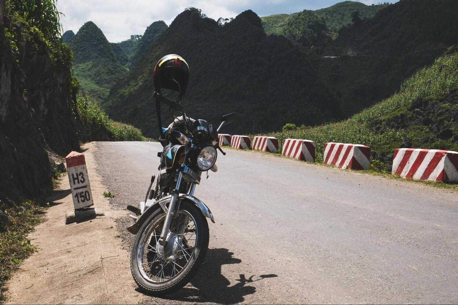
The best way to experience the Ha Giang Loop is by motorbike. This mountain road is close to the Vietnam-China border.
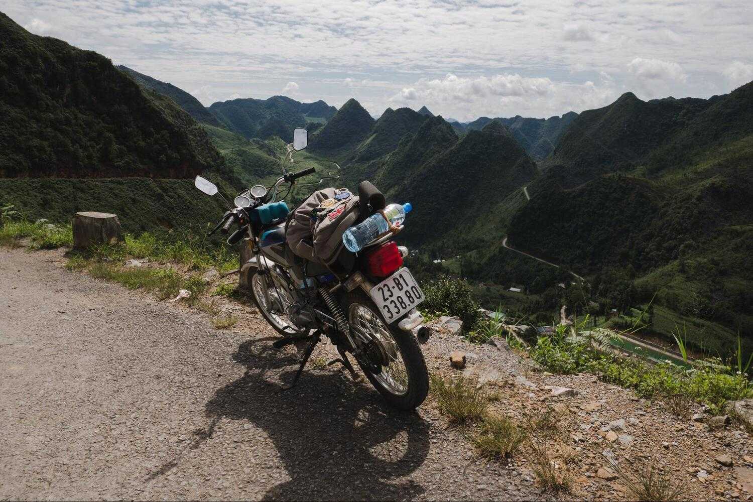
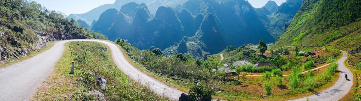
Motorbiking the Ha Giang Loop takes you through picturesque terraced fields and winding roads
The land here is mostly rocky fields with little space for farming. The joy of this journey comes from traveling through breathtaking nature.
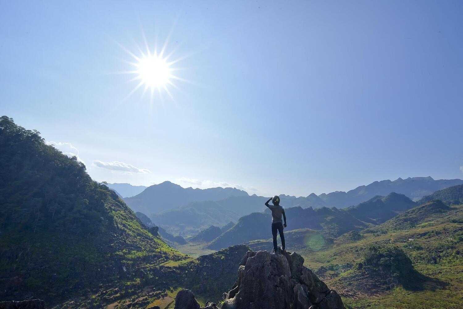
The landscape is stunning, but what’s even more impressive is the bright and resilient spirit of the people living in this harsh climate.
There are many ways to explore northern Ha Giang by road. This 5-days itinerary is just one option. Feel free to change it for your own adventure.
You can rent a motorbike from QT Motorbikes and Tours or NoMadders, but other companies are available too. Make sure to check the permit and license requirements before you start your trip.
This is the overview of Ha Giang Loop map:
Ha Giang Loop 5-Day Adventure Breakdown Guide
Day 1: Hà Giang to Quản Bạ
- Total distance: 65km
- Overview: QL4C North -> Tham Luồng Cave (1 hour stop) -> Bắc Sum Pass -> Bình An Linh Từ Shrine -> Heaven’s Gate Pass -> Tam Sơn (lunch at Yến Ngọc Cafe) -> Nặm Đăm (overnight stay at Dao Lodge)
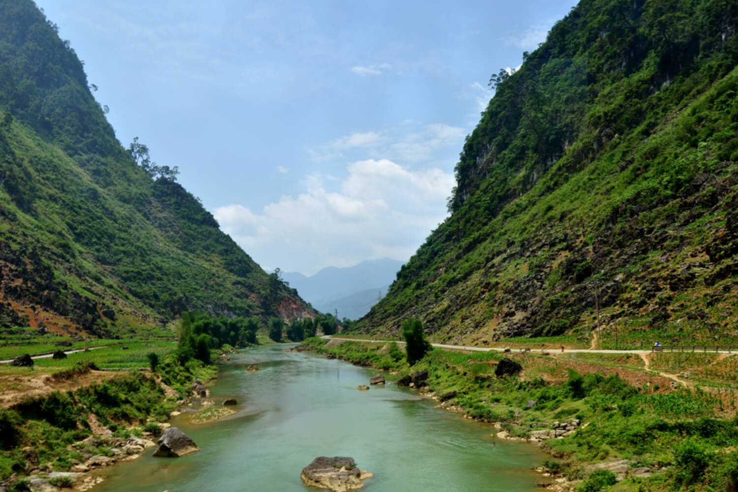
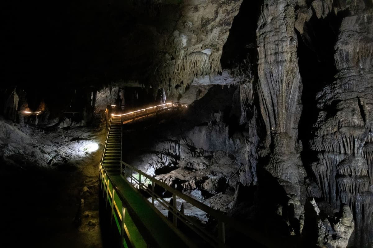
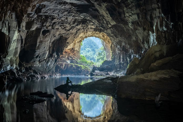
Start your Ha Giang Loop adventure by taking Road QL4C north from Hà Giang towards Tam Sơn. After a few kilometers, you’ll see tall limestone mountains and blue rivers (seasonally). About 30 km in, you'll reach Tham Luồng Cave. It’s a good spot if you’re new to limestone caves. This stop adds about an hour to your trip and involves climbing many stairs.
Next, drive up Bắc Sum Pass. It offers great views of Hà Giang City. When the road levels out, you’ll reach Bình An Linh Từ Shrine on a hill. It’s a nice place to stretch your legs. Continue past a Bố Y homestay (a small ethnic group in Vietnam) before starting the climb to Heaven’s Gate Pass.
Heaven’s Gate Pass leads you to Tam Sơn, a town in a valley surrounded by conical hills. Near the top, there’s a viewpoint with a coffee shop. Climb the steps behind the cafe to a small gazebo for panoramic views. Ride a bit further to see the “Fairy Bosoms,” a famous local landmark.
Tam Sơn (or Quản Bạ town) itself is quite ordinary. Most people stop for lunch at Yến Ngọc Cafe before moving on. If you’re staying overnight, head to the Dao village of Nặm Đăm, 6 km up a side road. There are many homestays here, including Dao Lodge. The guesthouse, designed by 112 Architects from Hanoi, blends modern design with traditional architecture.
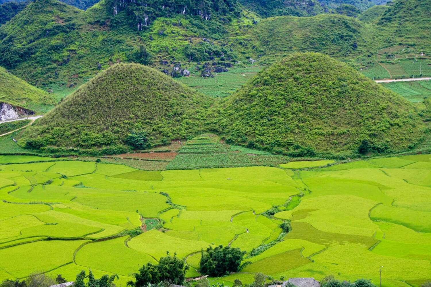
Clear weather days offer the best visibility and photo opportunities of the twin peaks in Nam Sơn
Day 2: Quản Bạ to Yên Minh and Lô Lô Chải
- Total distance: 57km
- Overview: Nặm Đăm -> Miện River North -> Yên Minh -> Dốc Thẩm Mã -> Nine-Turn Pass -> Sà Phìn (petrol & food) -> Phó Bảng (detour) -> Vương Palace -> Sủng Là Valley -> Lũng Cú Flag Tower -> Backtrack to fork -> Lũng Cú -> Khe Lía Panorama -> Lô Lô Chải (overnight stay)
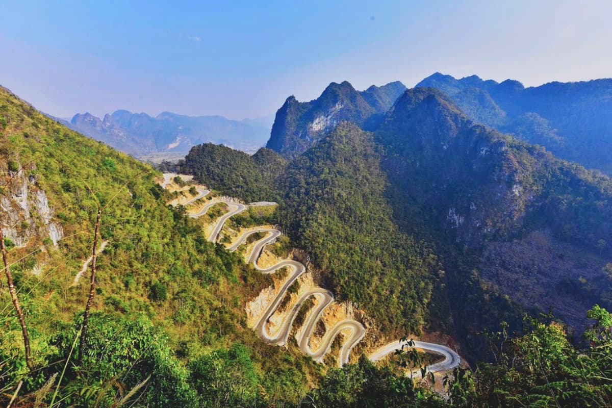
Start your journey heading north along the Miện River. The road then turns east, winding through terraced farms and pine forests until you reach Yên Minh. As you continue, the landscapes along the Ha Giang Loop become even more breathtaking. The road climbs up Dốc Thẩm Mã and the Nine-Turn Pass, which is a great spot for photos. From the top, you can see the road winding down to a flat valley surrounded by limestone mountains. Make a stop for petrol and food in Sà Phìn.
Take a short detour to Phó Bảng, an ethnic Chinese town about 20km north of Yên Minh. Next, visit the impressive Vương Palace, the royal residence of the Hmong people. After lunch, continue your trip to Sủng Là Valley and admire the Lũng Cú Flag Tower, which sits at 1400 meters (4593 feet) above sea level.
Then, backtrack slightly to the fork in the road and head north to Lũng Cú, known as Vietnam’s North Pole. This area is popular with young Vietnamese travelers who come by motorbike from Hanoi. At Khe Lía Panorama, follow the Lũng Cú road north. Here, you’ll find a tall flag tower with great views of China. Entry costs a few dollars, and you can pay extra for a buggy ride.
Nearby Lô Lô Chải village offers some homestays that are charming and rustic, like small boutique hotels. The village is home to the Lô Lô people, known for their unique, colorful clothing. You can spend the night here.
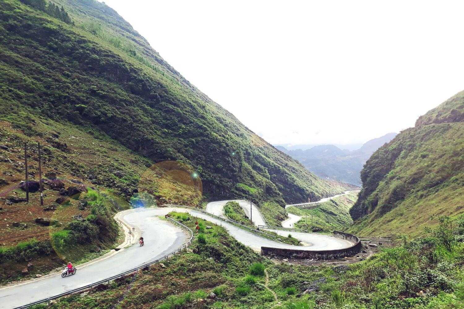
Nine-Turn Pass is famous for its 10 hairpin turns, offering stunning panoramic views
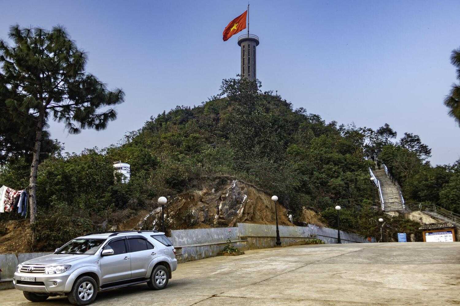
Lung Cu Flag Tower is accessible by a scenic drive through rugged terrain
Day 3: Lũng Cú to Mèo Vạc
- Total distance: 50km
- Overview: Khe Lía Panorama -> DT182B East -> Đồng Văn (QL4C) (food and petrol) -> Mã Pí Lèng Pass -> Nho Quế River (boat trip) -> Sa Li Pass -> Mèo Vạc (overnight stay)
The road from Lũng Cú to Đồng Văn is easy to follow. Go back to Khe Lía Panorama, then head east on DT182B. Alternatively, return west from Khe Lia Panorama to visit the Hmông kings palace. From there, travel east on QL4C to Đồng Văn (follow the red line on my map).
From the palace, QL4C takes you east on a winding 15 km road around limestone cliffs, a dramatic stretch of the Ha Giang Loop. The road is carved into the mountains, hugging rocky edges. Explore the countryside lanes if you wish; they rise from the road before disappearing into clouds or hills.
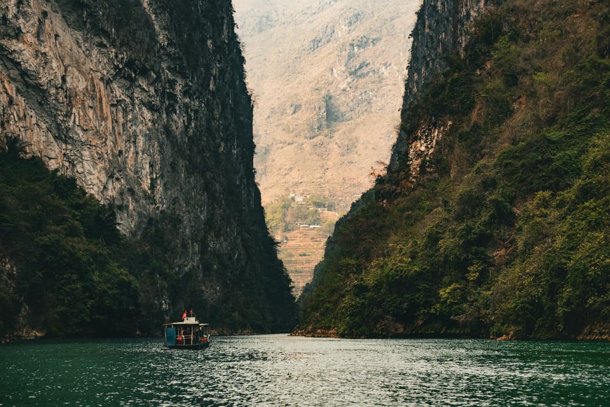
Mèo Vạc is just 24 kilometers from Đồng Văn. The route is the famous Mã Pí Lèng Pass, with rolling hills that drop to the Nho Quế River and its green gorge. You'll want to stop often to admire the huge mountains and small waterfalls along the way. The Nho Quế River, which flows from China, is right in the mountains. You can take a boat ride on the lake and see locals fishing.
After the boat trip, ride on bumpy dirt roads for about an hour and a half. This section is tough but offers a great view of the Sa Li Pass. Seeing the winding mountain roads from above is a highlight. Spend the night in Mèo Vạc, where you can stay at the unique Auberge de Mèo Vạc, a restored Hmong house from the 19th century. Mèo Vạc also has many hotels, mostly around the central stadium, and is surrounded by towering limestone karsts.
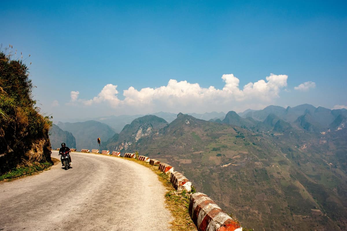
Expect challenging driving conditions with steep inclines and narrow roads
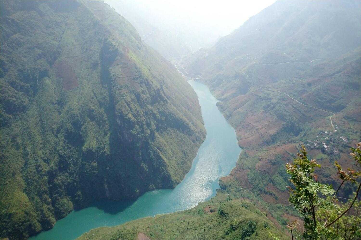
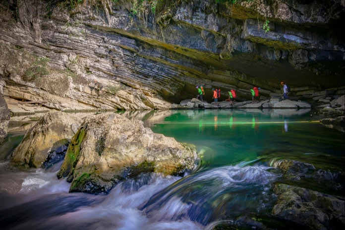
The river’s clear water allows for unique reflections of surrounding mountains and sky
Day 4: Mèo Vạc to Du Già
- Total distance: 75km
- Overview: Mèo Vạc (DT182/DT176 West) -> Lũng Phìn -> Mậu Duệ -> DT176 South -> Old French Fort Ruins -> Du Già (food and petrol, overnight stay) -> Du Già Waterfall
Start your journey from Mèo Vạc on Road DT182 (later DT176) heading west to Mậu Duệ, one of the highlights of the Ha Giang Loop. This road takes you through a rugged limestone valley with steep mountain sections. Along the way, you’ll find Lũng Phìn, a charming spot with old houses, a lively morning market, and a temple built into the rock. Mậu Duệ is a small village with coffee shops and restaurants along the main road.
Once in Mậu Duệ, you might think the dramatic views are over. But don’t worry! Continue south on DT176. This road leads you over high, jagged limestone peaks and down through pine forests and valleys. There are several roadside cafes where you can enjoy the views.
You can also visit the old French fort ruins, built around the same time as the fortress in Đồng Văn. There is no information plaque, so it’s a bit of a mystery.
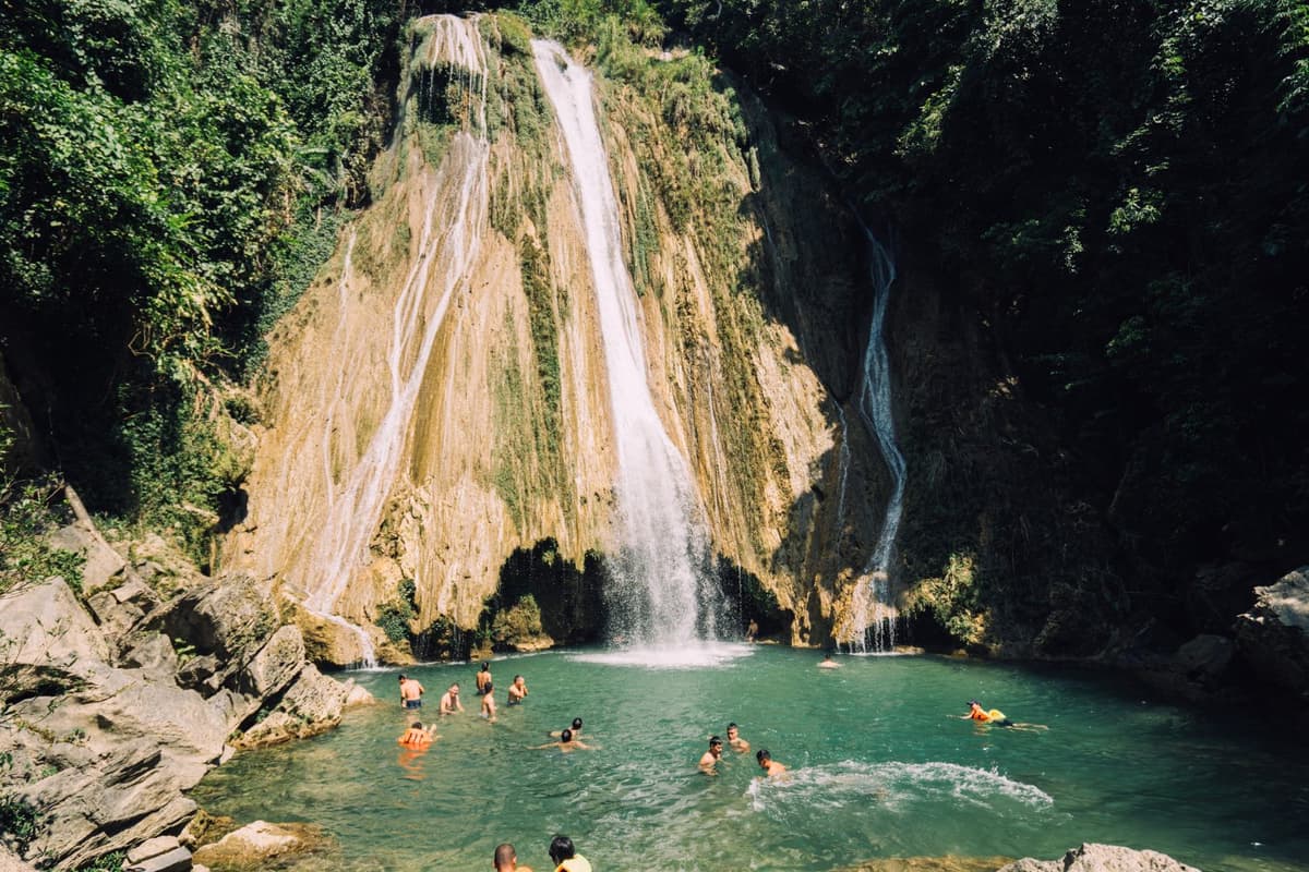
Prepare for an amazing descent into the peaceful valley of Du Già. Here, you'll find small places to stay like Du Gia Panorama, Tom’s Du Gia Homestay, and Tơ Dày Du Già. They are surrounded by green rice terraces in summer. From here, you can walk to Du Già Waterfall. Visit at sunrise to avoid crowds, or at sunset for a lively atmosphere. There are many activities in the area, such as swimming in the river, fishing, and hiking. You can arrange these activities through your accommodation.
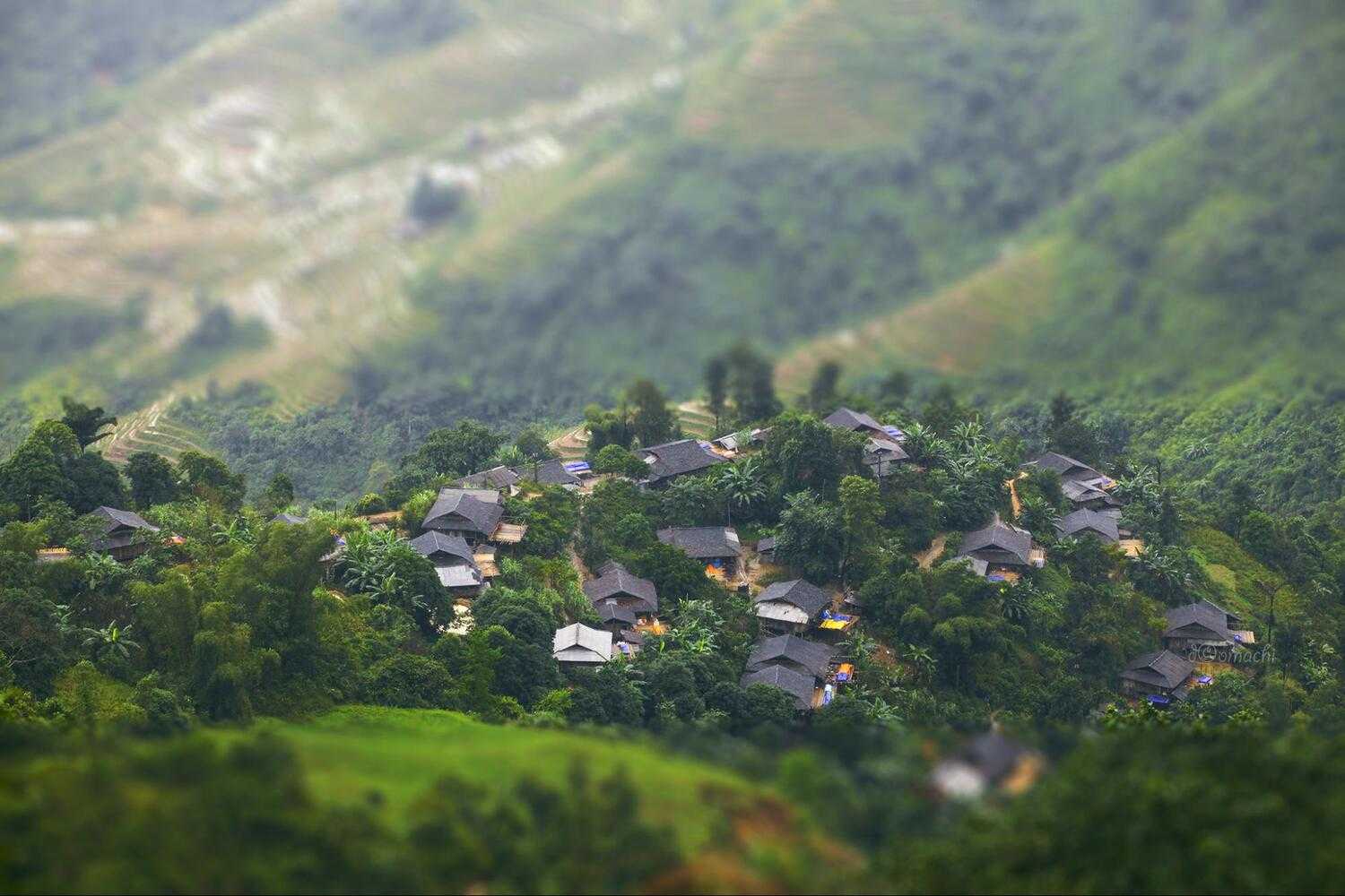
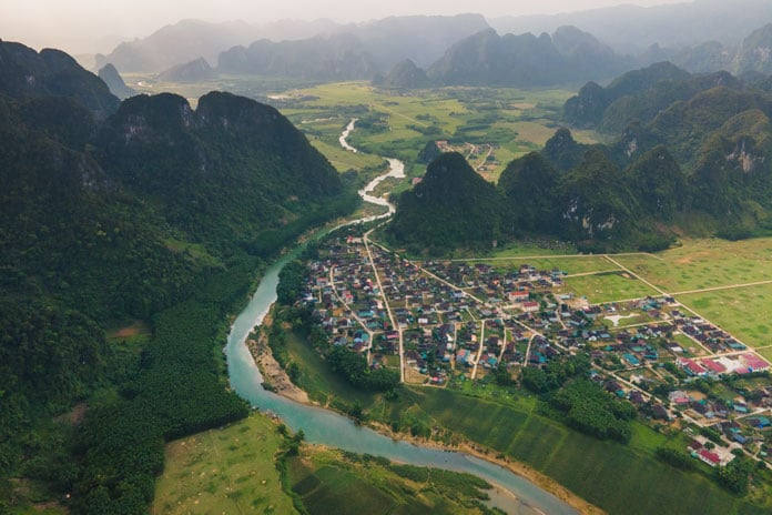
The valley is famous for its picturesque landscapes and ethnic minority villages
Along Đường Thượng, Du Già, you’ll find numerous photo opportunities of nature and local life
Day 5: Du Già to Hà Giang City
- Total distance: 98km
- Overview: Section 7 -> French fort junction -> DT181 West (food and petrol on the way) -> Miện River (heading south) -> A Boong Waterfall -> QL4C -> Hà Giang City
Google Maps might suggest heading south from Du Già to Hà Giang City. This route seems like a good way to finish your journey, but DT176 is in poor shape and won’t improve soon. Instead, go back the way you came from Section 7 to the French fort junction. This part of the road is even more beautiful going back. Then, turn west onto DT181. This road is mostly good, with only a few rocky spots.
When you reach the Miện River, take the unnumbered road heading south. This scenic road has occasional landslides but is generally good. As you descend towards Hà Giang, you will pass A Boong Waterfall and a river viewpoint.
Continue on this road until you meet QL4C. From there, it is just 10 km to Hà Giang City. This completes your Ha Giang loop.
Miện River is less crowded, offering a peaceful escape from popular tourist spots
How To Book The Ha Giang Loop Road Trip
In Hà Giang City, you can find many motorbike rental places. Most are on the east side of the river, on Nguyễn Thái Học Street and nearby blocks. Look for a place with a clear price list (usually per day), good helmets, and staff who speak some English.
You’ll need to leave some ID as a deposit, but avoid giving your passport. You’ll need it for your journey. If you must, take photos or photocopies instead.
Consider these options: Ngân Hà Travel, Kiki’s House, Style Motorbikes, and QT Motorbikes. Booking in advance is usually not needed unless it’s a public holiday. If one place doesn’t have the bike you want, try another.
Rentals cost between 150,000 VND and 500,000 VND per day, depending on the bike. For off-road adventures, you can book a full package Ha Giang Loop tour with a guide or hop on the back of a motorbike with an “easyrider” who will handle transportation, accommodation, and meals. You can book Ha Giang Loop easyrider tour directly at homestays in Hà Giang or through local agents in Hà Nội. Check out Flipside Adventures, Jasmine or Mama’s,...
Ensure your motorbike is well-maintained before starting your Hà Giang adventure
What to Know Before Doing the Ha Giang Loop
Packing Guide
- Seasonal clothing. Check the weather before you pack. Bring enough clothes for 3-5 days. Be ready to get dirty on the drive
- Good-quality closed-toe shoes, like trainers or boots
- Any medication you need
- A Ha Giang loop map. We recommend an offline Google Maps version
- Battery pack and chargers
- First aid kit
- Sunscreen
- Sunglasses
- Toiletries
- Waterproof jacket and backpack cover
- Camera or GoPro
- A reliable backpack
- Travel insurance
Note: If you’re going on a tour, contact the company for details on what to prepare.
Best time to go
The best times to take Ha Giang Loop trip are from March to May and September to November. During these months, the weather is warm and clear. The colors are bright, and there is little rain. In winter (December to February), it can be very cold. In summer (June to August), expect heavy rain. Even with less ideal weather, Hà Giang is still stunning. Many visitors enjoy the loop year-round despite the weather.
How to get to Hà Giang from Hanoi
The easiest way to reach Hà Giang is by taking a bus from Hanoi. The trip takes about 6-7 hours. You can choose from morning or evening buses. The cost is around 150,000 - 250,000 VND.
Language and Money
Most locals do not speak English, so learning some key phrases in Vietnamese is helpful. You can use an offline Google Translate app on your phone and consider buying a Vietnamese travel phrase book.
Even with a local SIM card, finding a cell signal on the road can be tough. Make sure to have offline maps and an offline translation app.
If you run out of money, you can find ATMs in Quản Bạ, Yên Minh, Đồng Văn, and Mèo Vạc. But, you won't find an ATM on every corner, and you can't exchange money after leaving Hà Giang. Plan your cash needs carefully!
Accommodation
Along the Ha Giang loop, there are many beautiful homestays, hotels, and guest houses. Finding a good place to stay is usually easy. Some places can be booked online, but booking in advance reduces the flexibility of your adventure.
Interestingly, many travelers told us they did not book in advance. Whenever they wanted to stop, they simply found a place to stay for the night. Most places will have "Homestay" written on a sign outside. Just knock on the door, and they will welcome you in.
If you are on a tour, you don’t need to worry about this.
Food and drink
If you want to stay in a homestay and eat well, book at least one day in advance. Let them know you want dinner. You can use Facebook, or Instagram to make this easy, even if you don’t speak Vietnamese. If you don't inform them ahead of time, you might end up with instant noodles for dinner. In the towns, food is available at mealtimes.
So, is the Hà Giang Loop worth it? Absolutely! With its breathtaking scenery, rich culture, and thrilling roads, it’s a must-see for any traveler. We hope this guide helps you plan your journey and enjoy every moment of the ride!
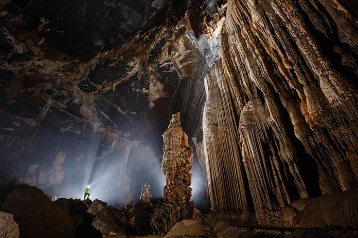
The Oxalis Experience.

Whether you prefer long treks, camping in a cave, sleeping under the stars in the jungle, swimming underground in river caves, explore the huge dry caves or just taking an exploratory day trip, Oxalis Adventure Tours can provide the right amount of adventure just for you.
__637051765075307793.jpg)
__637051782550081035.jpg)
__637051777074859032.jpg)
__637051780703588520.jpg)
__637051781488596056.jpg)
__637051767008903435.jpg)
__637051774329206026.jpg)
__637740499994967442.jpg)