Lung Cu Flag Tower: The Last Stop on the Ha Giang Loop, and One of the Best
Most travelers think Lung Cu Flag Tower is simply the final checkpoint of the Ha Giang Loop. And sure, standing beneath Vietnam's largest national flag at the country's northernmost point makes for a pretty epic photo. But that's only part of the story. The ride here winds through towering limestone mountains, quiet Hmong villages, and one of the most spectacular landscapes in Southeast Asia. Before you go, though, there are a few things you'll want to know. This guide covers everything from entrance fees and the required border permit to drone rules, the best time to visit, and practical tips to help you make the most of your trip.
What makes Lung Cu Flag Tower so iconic?
If you're driving the Ha Giang Loop, there's one stop that almost everyone looks forward to: Lung Cu Flag Tower. It's often called the northernmost landmark of Vietnam, but its appeal goes far beyond checking off a destination on the map.
Standing high above dramatic limestone mountains, with a giant Vietnamese flag waving in the wind, Lung Cu has become a powerful symbol of the country's identity, resilience, and unity. Here's why it's one of the most memorable places you'll visit in northern Vietnam.
It's not actually the northernmost point of Vietnam…
This surprises many visitors. Although Lũng Cú is often called "Vietnam's northernmost point," the country's true geographic northern tip lies about 3.3 kilometres further north near Border Marker 428 in Xéo Lủng village, close to the Nho Quế River.
So why does everyone come here instead? Because Lũng Cú is Vietnam's symbolic northern landmark. Sitting atop Dragon Mountain (Long Sơn) at nearly 1,470 metres above sea level, it has become the country's most iconic monument representing sovereignty along the northern frontier. From the summit, you can look across the dramatic limestone mountains toward China's Yunnan Province, a reminder of just how close the border really is.
The 54-square-metre flag isn't a coincidence
One detail almost every Vietnamese visitor knows is the size of the flag. The enormous national flag measures exactly 54 square metres (9 × 6 metres), representing Vietnam's 54 officially recognised ethnic groups living across the country.
It's also a practical design. Back in 1978, local H'Mông official Hùng Đình Quý helped oversee the construction of the road leading to Lũng Cú. He wanted a flag large enough to be visible from villages scattered throughout the surrounding mountains, turning it into a powerful symbol long before today's tower was built. Mountain winds are fierce at this elevation, so the flag is regularly replaced every week or so to keep it flying proudly.

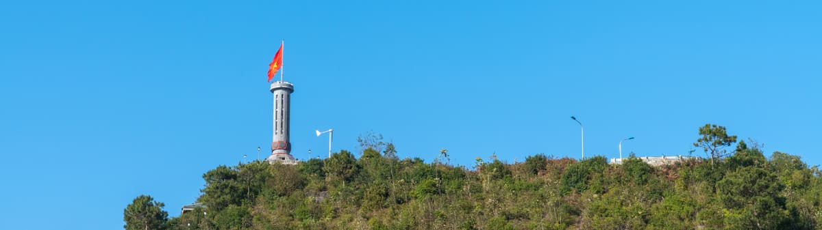
Lung Cu Flag Tower standing tall atop Dragon Mountain.
A place where history and legend meet
Like many places in northern Vietnam, Lung Cu blends historical facts with centuries-old legends. According to local tradition, the first flagpole here dates back to the Ly Dynasty, when General Ly Thuong Kiet raised a simple wooden flagpole to mark the northern frontier.
Later, during the Tay Son Dynasty, Emperor Quang Trung reportedly placed a large bronze drum on the mountain. The drum was beaten several times each day to signal the presence of Vietnamese forces, earning the mountain the name Long Co, meaning Dragon Drum. Over time, locals believe the pronunciation gradually evolved into today's name: Lung Cu.
Whether every detail is historically documented or not, these stories have become part of what makes the site so meaningful to Vietnamese visitors.
Architecture inspired by Vietnam's heritage
The current Lung Cu Flag Tower was completed in 2010, replacing earlier structures that had stood on the mountain over the years.
The octagonal design takes inspiration from the historic Hanoi Flag Tower, while the stone base is decorated with eight bronze drum-inspired reliefs. These carvings depict important chapters of Vietnamese history alongside scenes celebrating the traditions of Ha Giang's ethnic communities.
After climbing the staircase to the top, you'll be rewarded with sweeping views across rugged mountains, traditional villages, and rice terraces stretching toward the Chinese border.
Look beyond the tower
Most visitors climb the steps, take a few photos with the flag, and leave. Take a moment to look around instead. Below the mountain sit two small lakes known locally as the Dragon's Eyes. According to local legend, they're the eyes of a dragon that once watched over this land before ascending to heaven, leaving behind a permanent source of fresh water for nearby Lô Lô and H'Mông communities.
Whether you believe the legend or not, they add another layer of character to one of Vietnam's most meaningful landscapes.
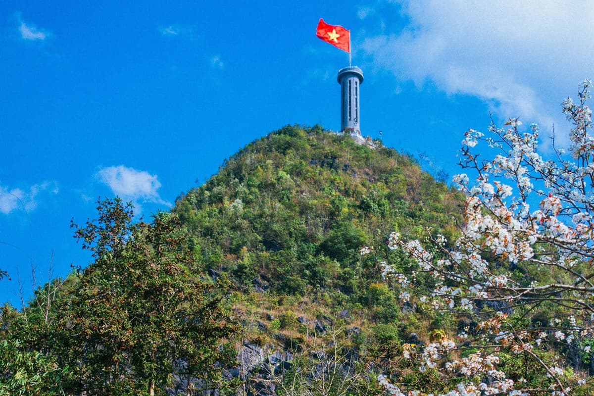
Scenic view of the flag tower framed by mountain blossoms.
How to Get to Lung Cu Flag Tower and Incorporate into Your Ha Giang Loop Itinerary
Lung Cu Flag Tower sits in Lung Cu Commune, Dong Van District, Ha Giang Province, near Vietnam's border with China. Although it's one of the most famous landmarks in northern Vietnam, it's far from the country's major cities.
Here are the distances most travelers need to know:
- Hanoi → Ha Giang City: approximately 300 km (6 - 7 hours by road)
- Ha Giang City → Lung Cu Flag Tower: approximately 150 km (5 - 6 hours, depending on road conditions)
- Dong Van Old Quarter → Lung Cu Flag Tower: around 24 km (45 - 60 minutes)
Because of its location, Lung Cu is almost always visited as part of the Ha Giang Loop, rather than as a standalone day trip.
Getting from Hanoi to Ha Giang
The journey typically begins in Hanoi, where travelers can take an overnight sleeper bus, limousine van, or private transfer to Ha Giang City. The trip usually takes between 6 and 7 hours.
Many visitors choose an overnight bus, arriving early in the morning and starting the Ha Giang Loop immediately. Those seeking a more comfortable experience often spend a night in Ha Giang City before heading into the mountains.
From Ha Giang City to Lung Cu Flag Tower
The road from Ha Giang City to Lung Cu covers approximately 150 km, but mountain roads mean the drive usually takes 5 - 6 hours.
Rather than rushing directly to Lung Cu, most travelers complete this section as part of the Ha Giang Loop, passing through some of northern Vietnam's most spectacular landscapes:
- Quan Ba Heaven Gate, where panoramic views open across limestone valleys and the famous Twin Mountains.
- Yen Minh, surrounded by pine forests and peaceful ethnic minority villages.
- Dong Van Karst Plateau UNESCO Global Geopark, home to dramatic rock formations, ancient Hmong communities, and winding mountain roads.
Many experienced riders also recommend taking sections of Provincial Road DT182, a quieter alternative to National Highway 4C that offers fewer vehicles and equally stunning scenery.
From Dong Van to Lung Cu
Lung Cu Flag Tower is located about 24 km north of Dong Van Old Quarter. Although the distance is short, expect the drive to take around 45 - 60 minutes due to steep roads and tight mountain curves.
Many visitors choose to stay overnight in Dong Van or Lo Lo Chai Village, which sits at the foot of Dragon Mountain, Ha Giang. This allows an early morning visit when temperatures are cooler, visibility is clearer, and the viewpoint is far less crowded than later in the day.
The final approach includes a scenic road through traditional villages before reaching the parking area. From there, visitors climb a series of stone steps to reach the flag tower itself.
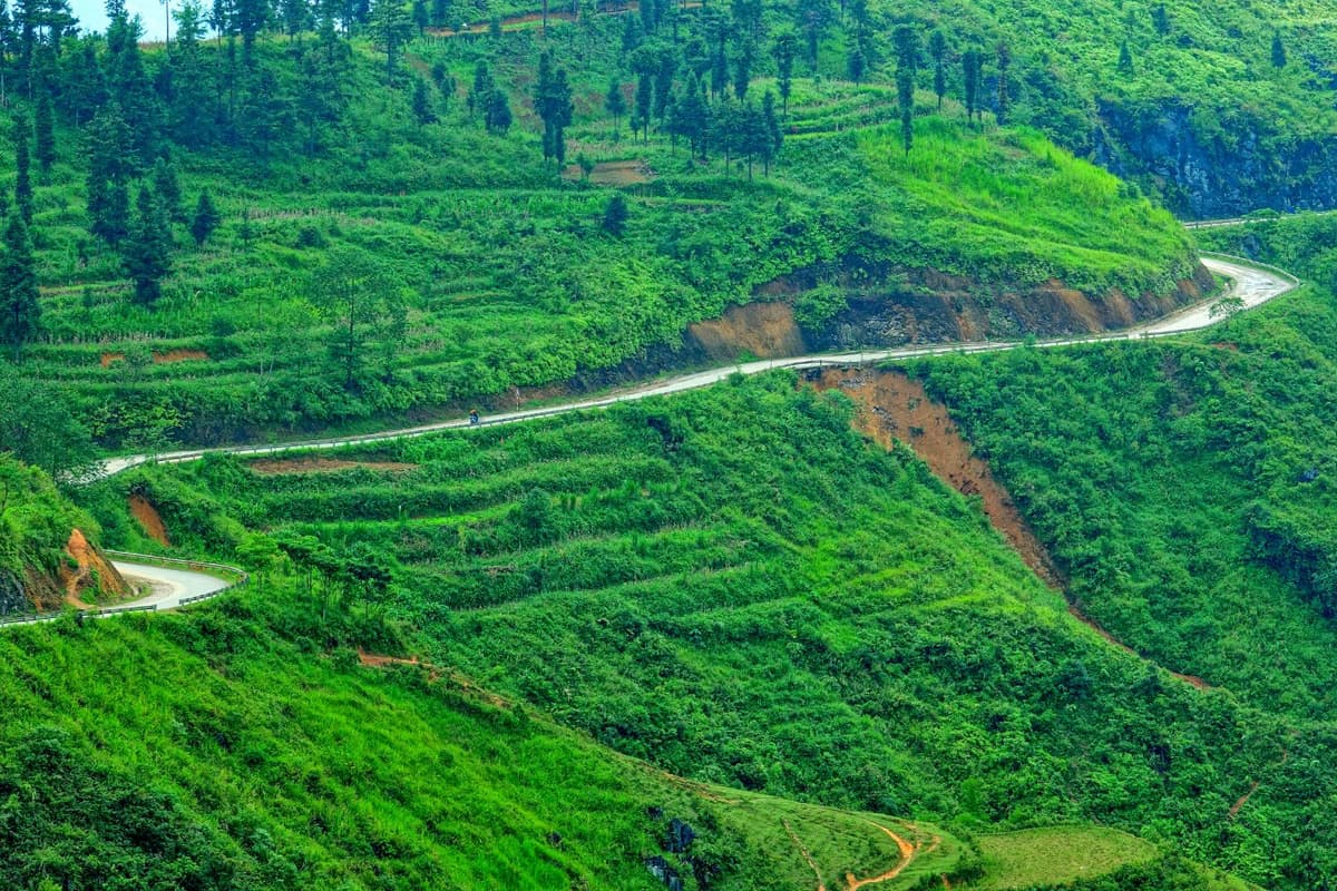
Winding mountain roads on the way to Lung Cu.
The Best Way to Include Lung Cu in Your Ha Giang Loop
Rather than rushing to Lung Cu in a single day, most travelers visit it during the final section of the Ha Giang Loop.
A typical itinerary looks like this:
- Day 1: Ha Giang → Quan Ba → Yen Minh
- Day 2: Yen Minh → Dong Van → Ma Pi Leng Pass
- Day 3: Dong Van → Lung Cu Flag Tower → Lo Lo Chai Village → return to Dong Van or continue the loop
This schedule gives you enough time to enjoy the mountain scenery without spending the entire day riding.
Many visitors also combine Lung Cu with nearby attractions such as Lo Lo Chai Village, where traditional clay houses and local cafés offer a quieter cultural experience just minutes from the flag tower.
Should You Stay in Dong Van or Lo Lo Chai?
If you're planning to visit Lung Cu, spending the night nearby is highly recommended. Dong Van is the most convenient base, offering a wide range of hotels, restaurants, cafés, and evening activities in its atmospheric Old Quarter.
For a more immersive experience, many travelers now choose Lo Lo Chai Village, located just below Lung Cu Flag Tower. Staying here allows you to experience traditional homestays, wake up surrounded by limestone peaks, and reach the tower before most tour groups arrive.
Early morning is widely considered the best time to visit, when temperatures are cooler, the light is softer, and the mountain views are often at their clearest.
Before setting off, keep these practical tips in mind:
- Break the journey into two stages. Travel from Hanoi to Ha Giang first, then begin the Ha Giang Loop the following day instead of rushing everything at once.
- Plan Lung Cu as the final highlight of the loop, combining it with Dong Van, Ma Pi Leng Pass, and the Nho Que River for a more rewarding itinerary.
- Foreign visitors need a Ha Giang border permit, as Lung Cu sits close to the Chinese border. Most tour operators, hotels, and motorbike rental shops in Ha Giang can help arrange it quickly.
- Fuel up whenever possible. Petrol stations become less frequent once you leave the larger towns.
- Avoid driving after dark. Mountain fog, sharp bends, and limited lighting make daytime travel much safer, especially for first-time visitors.
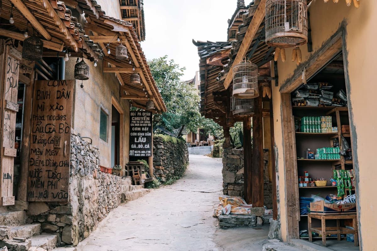
Narrow stone alley winding through Lo Lo Chai village.
Essential Visitor Info: Ticket Prices and Opening Hours
Reaching Lung Cu Flag Tower is more than visiting a landmark. It is a memorable journey to Vietnam's northernmost point, where breathtaking mountain scenery meets powerful national symbolism. Before setting off, it helps to know the latest opening hours, entrance fees, and what to expect during the climb so you can plan your visit comfortably.
Opening Hours and Best Time to Visit
Lung Cu Flag Tower is open daily from 8:00 AM to 5:00 PM. During peak travel periods, ticket offices may begin operating from around 7:00 AM, allowing early visitors to reach the summit for sunrise.
The most comfortable times to visit are:
- Early morning (7:30 AM to 9:30 AM) for cooler temperatures, soft light, and fewer visitors.
- Late afternoon (3:30 PM to 5:00 PM) for golden-hour photography and panoramic sunset views across the Dong Van Karst Plateau.
Midday can be hot, especially during summer, with limited shade along the stairway.
Ticket Prices and Visitor Services
Visiting Lung Cu Flag Tower remains very affordable for independent travelers.
- Entrance ticket: 25,000 VND per adult
- Children under 1.3 meters: Free admission
- Electric shuttle: 15,000 VND per person each way
- Parking fee: 5,000 VND per vehicle
The electric shuttle is recommended for visitors who prefer to conserve energy, as it skips the first uphill section from the parking area.
Most Lung Cu Flag Tower ticket counters accept cash only, so carrying small denominations of Vietnamese Dong is advisable before arriving.
The Climb to Lung Cu Flag Tower: Step-by-Step Journey to Vietnam's Northern Frontier
Reaching the summit of Lung Cu Flag Tower is a rewarding experience that combines light physical activity, cultural discovery, and spectacular views. Most visitors complete the climb comfortably in 30 to 45 minutes, allowing extra time for photos and rest stops along the way. The ascent is divided into several stages.
Stage 1: From the Parking Area to the Midway Courtyard
Your journey begins at the visitor parking area at the foot of Dragon Mountain. Travelers can either climb the entire route on foot or take the electric shuttle, which skips the steepest lower section of the ascent.
Those who choose to walk from the base will climb approximately 839 stone steps in total. Visitors using the shuttle significantly reduce the effort required, leaving only the upper stairways to complete on foot. Along the route, several covered rest shelters offer welcome opportunities to pause, enjoy the cool mountain breeze, and take in panoramic views of the Dong Van Karst Plateau.
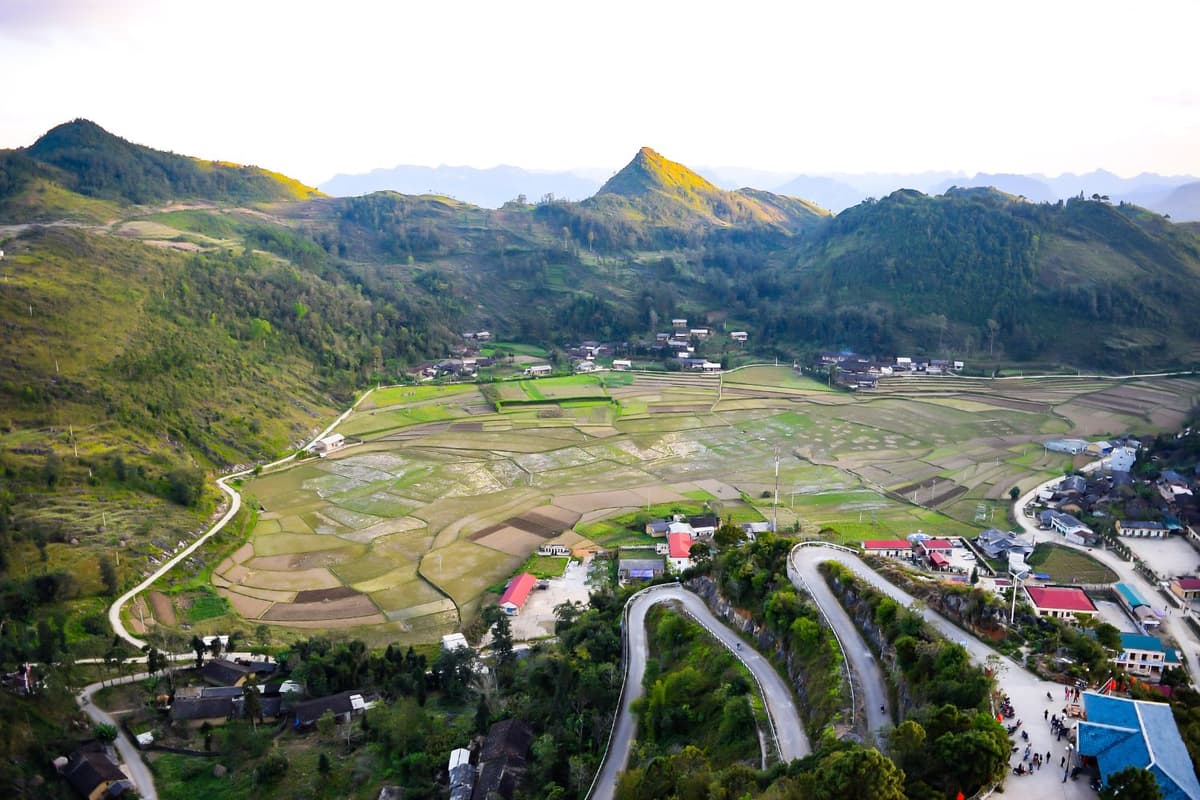
Panoramic valley view from the climb up Dragon Mountain.
Stage 2: Reaching the Flag Tower Platform
After the final outdoor staircase, visitors arrive at the base of Lung Cu Flag Tower. The tower rises 33.15 meters above an octagonal stone pedestal inspired by the historic Hanoi Flag Tower.
Before continuing upward, spend a few moments admiring the intricate stone reliefs surrounding the platform. These carvings showcase Dong Son drum patterns, important chapters of Vietnamese history, and the cultural heritage of the ethnic communities that have lived in Ha Giang for generations.
Stage 3: Climbing to the Observation Deck
The final part of the journey takes place inside the tower itself. A narrow spiral staircase with approximately 140 steps leads visitors to the observation platform beneath Vietnam's northernmost national flag.
The staircase is relatively steep but well maintained, with handrails available throughout the climb. Within just a few minutes, you emerge beneath the iconic 54-square-meter Vietnamese flag, representing the country's 54 ethnic groups. From the summit, uninterrupted views stretch across the Dong Van Karst Plateau, Lo Lo Chai Village, the Dragon's Eyes Lakes, and, on clear days, the mountains of Yunnan Province in China, making the climb well worth the effort.
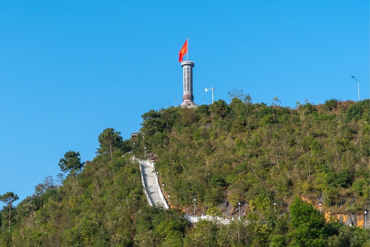
Stone stairway leading up to Lung Cu Flag Tower.
Worth-Spanning Side Trips: Must-Visit Spots Near Lung Cu flagpole
After visiting Lung Cu Flagpole, take time to explore the surrounding villages and geological landmarks. These nearby attractions reveal the cultural diversity, ancient history, and dramatic landscapes that make Vietnam's northern frontier one of the most rewarding sections of the Ha Giang Loop.
Lo Lo Chai Village
Located just below Dragon Mountain, Lo Lo Chai is one of Vietnam's best-preserved ethnic villages and was recognized by UN Tourism as one of the World's Best Tourism Villages. Visitors can admire centuries-old rammed earth houses, meet the Black Lo Lo community, experience traditional weaving, and enjoy a slower pace of life surrounded by the Dong Van Karst Plateau.
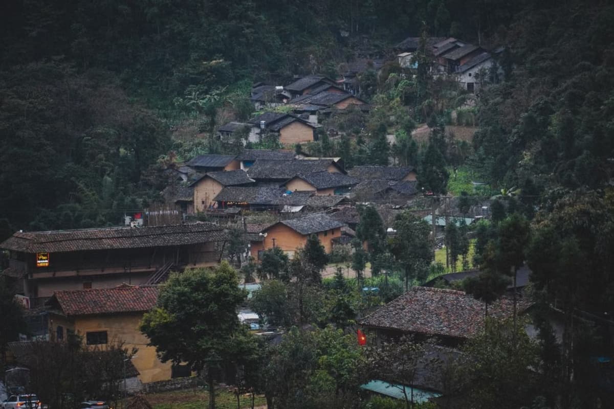
Traditional rammed-earth homes in Lo Lo Chai Village.
Border Marker 428
For adventurous travelers, Border Marker 428 marks Vietnam's true northernmost geographical point. The trek follows rugged mountain trails close to the China border and requires a local guide due to restricted border regulations. Along the way, hikers enjoy spectacular mountain scenery and a unique sense of standing at the country's northern frontier.
Then Pa Village
Then Pa Village offers a peaceful alternative to the more visited attractions around Lung Cu. Traditional rammed earth homes, quiet mountain scenery, and authentic local life make it an excellent stop for travelers interested in community-based tourism, photography, and cultural encounters beyond the main tourist route.
Ha Sung Ancient House
Around 3 km from Lung Cu Flagpole, Ha Sung Ancient House showcases more than a century of local architectural heritage. The residence combines Hmong rammed earth construction with influences from southern Chinese design, offering visitors a fascinating glimpse into the region's cross-border cultural history.
Xi Man Kha Fossil Site
Xi Man Kha is one of the Dong Van Karst Plateau's most remarkable geological sites. Exposed rock layers preserve marine fossils dating back nearly 400 million years to the Devonian Period, including ancient fish, brachiopods, and crustaceans. The site illustrates how today's limestone mountains were once part of an ancient seabed.
What to Eat Near Lung Cu Flag Tower: Authentic Local Food You Should Try
The remote villages surrounding Lung Cu Flag Tower preserve a distinctive mountain cuisine shaped by the Dong Van Karst Plateau. Many recipes have been passed down through generations of Hmong and Lo Lo families, using locally grown corn, native herbs, and traditional cooking methods that reflect everyday life in Vietnam's northern highlands.
- Lo Lo Corn Wine: This traditional corn liquor is naturally fermented with a unique blend of forest herbs, creating a smooth yet robust flavor. Often served to welcome honored guests, it remains an important symbol of hospitality among Lo Lo and Hmong communities.
- Thang Co: One of Ha Giang's signature specialties, this slow-cooked horse meat stew combines various cuts of meat with mountain herbs and aromatic spices. It is commonly enjoyed during local markets and festivals, especially on cooler mountain days.
- Men Men: Steamed cornmeal is a staple food throughout the rocky plateau, where rice cultivation is limited. Prepared by steaming finely ground corn twice, Men Men has a light, fluffy texture and is traditionally served alongside soups, stews, or stir-fried dishes.
- Buckwheat Cake: Made from locally grown buckwheat, this soft grilled cake has a subtle nutty aroma and mild sweetness. It becomes especially popular during the buckwheat flower season and is an easy snack to enjoy while exploring Lung Cu and nearby villages.
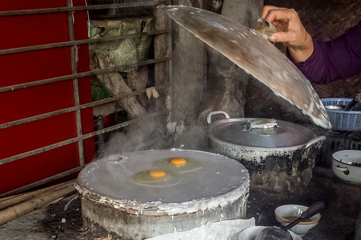
Local food preparation near Lung Cu Flag Tower.
Practical Insider Tips for Western Travelers
A little preparation goes a long way when visiting Lung Cu Flagpole. From choosing the right season to understanding local customs, these practical tips will help you enjoy a safer, smoother, and more rewarding experience in Vietnam's northernmost region.
- Visit during the best seasons: September to November offers golden rice terraces and blooming buckwheat flowers, while March and April bring peach and plum blossoms across the mountains. Avoid June to August, when heavy rains can make mountain roads slippery and landslides more likely.
- Choose the right motorcycle: The winding roads to Lung Cu feature steep gradients and sharp hairpin bends. Manual or semi-automatic motorcycles provide better control on descents than automatic scooters, making them the safer choice for the Ha Giang Loop.
- Pack warm clothing: Despite its tropical location, Lung Cu sits at nearly 1,500 meters above sea level. Temperatures are noticeably cooler than in Ha Giang City, especially in the morning and evening. Bring a windproof jacket, comfortable hiking shoes, and light gloves during cooler months.
- Travel light: Skip large suitcases if you're exploring by motorcycle. A compact backpack is far more practical on mountain roads. A poncho-style raincoat is also recommended, as it keeps both you and your backpack dry during sudden mountain showers.
- Plan your transportation: Many travelers take an overnight bus from Hanoi to Ha Giang before starting the loop. Ride-hailing apps such as Grab and Xanh SM are useful in larger cities, while platforms like 12Go make booking long-distance buses simple and convenient.
- Strictly observe drone regulations: Lung Cu and surrounding border communes lie within a restricted national security zone along the Chinese border. Flying a drone (flycam) without an official military permit issued by the Ministry of National Defence is strictly prohibited. Border guards actively enforce this rule; unauthorized drones will be confiscated and operators heavily fined. Unless you hold an approved permit, leave your drone packed away.
- Respect local communities: Lung Cu is home to Hmong and Lo Lo ethnic groups with strong cultural traditions. Always ask permission before photographing local people, dress respectfully when visiting villages, and help preserve this fragile border region by leaving no litter behind.